 |
 |
|

On November 5, 2006, I hiked the Tanner trail with fellow Coconino Astronomical Society member, Dennis Foster, and his step-son, Eric. We met at 6:00 am in a parking lot on the east side of Flagstaff, piled our gear and ourselves into my Isuzu Rodeo, and hit the road. About 90 minutes later, we pulled into the Desert View parking lot just in time to see the Moon set and the sun rise. After admiring the view of the Colorado River from Desert View overlook, we returned to the Rodeo for the short drive to Lipan Point and the Tanner trailhead.
An unmaintained trail with limited shade and no reliable water sources, Tanner is considered one of the more difficult hikes in Grand Canyon. It runs 7.6 miles from the rim to the river with the initial decent from Lipan Point being steep and rocky. After reaching the canyon bed, the slope eases considerably but Tanner remains fairly rugged with some minor boulder hopping required. The trail runs generally north past Seventyfive Mile Saddle where it begins contouring around the eastern slopes of Escalante and Cardenas buttes. Eventually, this relatively level section transitions into a knee-jarring decent through the Redwall to Tanner canyon and, eventually, a fine beach at the Colorado River.
Our destination was the Redwall overlook about 3.5 miles from the trailhead. Approaching Seventyfive Mile Saddle, we spied a tent and two hikers moving about. This open ridge offers fine views to the west through Seventy-five Mile Creek canyon. The campers appeared to be just beginning their day. So, with a wave of the hand and a, "Good morning," we continued on our way. Later, we encountered a three-person group that was hiking out after spending a night at the Redwall overlook under a Harvest Moon. We met them soon after cacheing several liters of water at a large, black boulder about half a mile from the overlook.

We arrived at the Redwall overlook about 2 and 1/2 hours after entering the canyon. It was a relief to remove our boots, and splendid to kick back and take in the grandeur while eating lunch. The soft churning of Tanner rapids was audible from our perch. Looking east, we were treated to a fine view of the Palisades of the Desert. To the north and east, we could make out Chuar Lava Hill and Temple Butte across the Colorado.
After lunching on the Redwall, Dennis asked if Eric and I were feeling adventerous. We answered in the affirmative so, rather than retracing our steps on Tanner, Dennis led us on a circumnavigating traverse to the west around Cardenas Butte. The route began easily enough, following the northern slope of Cardenas above an unnamed drainage. At the apex of the drainage, we angled north and upward toward a saddle along the adjacent ridge. Having crossed over this saddle, the route turns south toward a saddle between the west slope of Cardenas and a thumb-shaped formation. Harvey Butchart describes a route from this thumb to the Escalante route along the Colorado. That we weren't the first to have visited this part of the canyon was evidenced by the few rock cairns encountered on our trek.
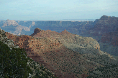
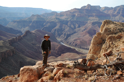
The thumb saddle offered fine views to the west so, we paused for water and a photo op before continuing the traverse. We were aiming to reach the saddle between Cardenas Butte and an unnamed peak further south along the same ridge. The western slope of Cardenas is steeper than the first section of this traverse. As a result, I was feeling less comfortable about the little slips and slides in my foot traction. The route required some moderately challenging scrambling and cost Eric one broken hiking pole-tip. But we eventually reached the saddle and our reward was some outstanding vistas.

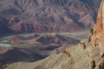
One of the more inspiring views from this saddle is north toward Unkar rapids. The Colorado makes a hairpin turn, at Unkar, to the south and east. Then, just as abruptly, the river doubles back to its general southwesterly course. A thumb of low canyon desert opposite Unkar delta is enwrapped by the first hairpin in the river. And this thumb is dominated by a large butte. Dennis pointed out an interesting feature of the butte at Unkar rapids. Along the edge near the southeast corner, an Anasazi ruin can be seen as a black dot against the landscape. Now, that would make for an interesting stop on an Escalante hike. We were also treated to a fine view of the Desert View watchtower silhouetted against the late afternoon sky.
After a water break and a well-deserved snack, we scrambled downslope to the east to reconnect with Tanner trail and were soon back at our water cache. After re-filling my Camelbak, an easy 20-minute hike brought us to Seventyfive Mile Saddle. The route-finding and scrambling along the western slope of Cardenas had taken a lot out of us--particularly me--and we were only a mile-and-a-half from the trailhead. But now, the real work would begin.
By now, it was late in the afternoon and we wanted to make the rim before nightfall. Seventy-five Mile Saddle is at an elevation of roughly 5,635-feet. Over the final ascent, Tanner would lead us to Lipan Point at 7,380-feet, a climb of about 1,750 vertical feet. I'll admit I was really suffering over the last 1/2 mile. The experience reminded me of gremlin I encounted a few times during a past life as a road cyclist. In cycling, we say a rider who suffers call a sudden and complete loss of energy has bonked. And that's what happened to me on Tanner; I bonked. It was this experience that led me to try Gookinaid--an electrolyte replacement mix--on my next hike.
It took 90 minutes to make that final climb. But I made it, reaching the rim just after 6:00 pm, which was just in time to see the Moon rise and catch the last crimson light of day splashing across the face of Grand Canyon. Despite the grueling final ascent, the Tanner hike made for a great day. I really enjoy making short departures from the established trails to do some route finding and exploring. That's the way Grand Canyon needs to be seen to be fully appreciated. It's a wild place; one that should be met on its own terms. I can't wait to make a multi-day trip in this part of Grand Canyon.
Bill Ferris
Flagstaff, Arizona
 |
 |
 |